Thursday, October 29, 2015

Friends of Bluewater Lake

I attended the initial meeting of the Friends of Bluewater Lake. This was an information meeting on how to get an association started and to advocate for and raise money for the “friends” to assist the lake in developing more opportunities at the lake. Everyone interested in the Lake’s success is welcome, not just fishermen, and boaters. As I also had to attend the other meeting, I bounced back and forth between this meeting and the Cibola County Commission meeting, so I may have missed a few things, but a summary of the “equestrian” portion is below. Jackie Weeks may be able to provide more specific info on certain items if necessary.
 
We did get into a minor discussion of the previous exclusion of equestrian from the lake. That was a past administration, and any animosity toward equestrian was not found among the current administration. Those of you who were asked to leave in the past, let it be known that they won’t run you out again. There currently is not a camping site available for horses so don’t expect to drive in and camp at the main parking area. For safety reasons, the Park won’t let you camp there. However they are completely open to development of an equestrian friendly campsite. Equestrian are welcome to ride the park and assist in trails development as well. 

The Park personnel are also in discussions with our Zuni Mountain Trail Partnership to work on developing a trail from the south end of the park to connect into the proposed Zuni Mountain Trails in the USFS just a mile away.

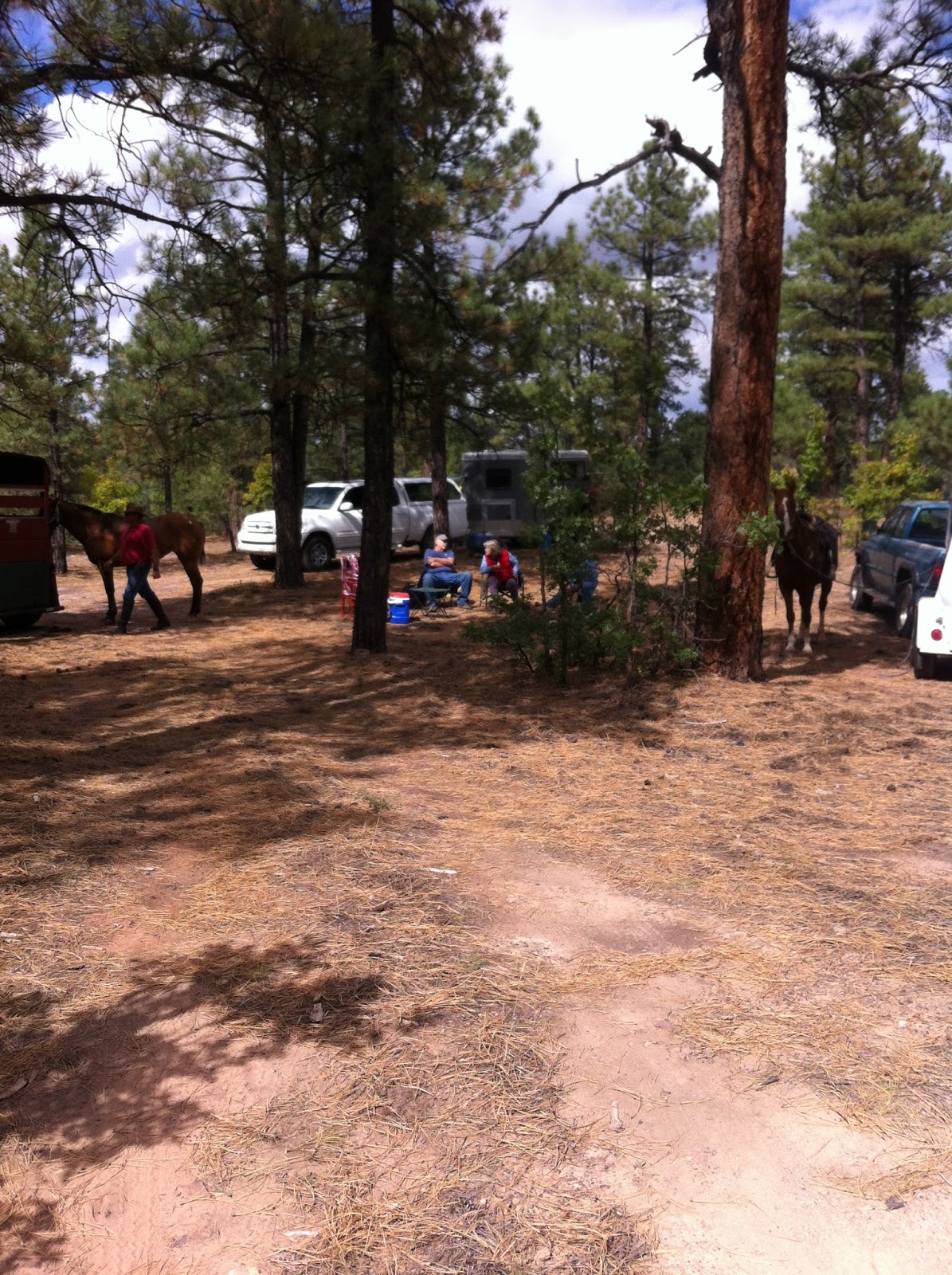
Right now the biggest concern the park staff has is the interactions of the feral horses coming in from the section of Navajo Tribal land that may harass and or attack the riders and their horses. When we rode the park years ago, we never really had a problem with this, but it is still of some concern. 

When asked about the rules of Equestrian in the park. Several questions were brought up.


1.    Trish from the Bluewater Lake Lodge and horse motel (great place to go visit) had said that she had been told that a person couldn’t drive INTO the lake lands with a horse trailer and unload. They would have to ride in on the main road across a cattle guard. The park staff said that was incorrect and they would allow horse trailers into the park. (Note: The staff was unprepared for some of these questions as they weren’t aware it had been in issue in the past, so we (probably me) will have another meeting direct with the park staff to discuss locations and safety etc.

2.     Jackie asked what the restrictions on horses/equestrian use in the park was. The only significant thing was not to have the horses drink or be in the lake, but that it was mainly an “At your own risk” issue. If your horse gets bogged down in the lake, then it’s your fault not the lake’s problem. Again we may need to have some discussions on safety and use and help create a set of rules.

3.     Trail use: We discussed the trail use and the park staff indicated that the trails development would be non-motorized multi-use. And we are welcomed to assist in developing trails and providing input to the park.

So what does this all mean for us? Well, the development of a “Friends” group outside of the state financial control means that we as a group can fund the projects that are important. We as a “group” can help develop trails, the camping areas, bring in events to the park as fund raisers etc. So if you like to ride and your spouse likes to fish or hike, you can help the park develop both resources. 

We can do this in a couple of ways.

1.    We can join the “Friends of Bluewater Lake” and have direct input as the project priorities and development of equine inclusive facilities.

2.    We can assist as the Back Country Horsemen Chapter, and have indirect input and aid to developing the trails. 

3.     Or we can do a little of both. 

I’m not saying that everyone has to join either association, but if we have at least one equestrian representative in the “Friends” group working from the inside and a few working from the BCH side, we could help develop an awesome camp site and equestrian friendly facility. 

I don’t know how many of you have ever been to the El Caballo Lake State Park down in T or C, but they have an awesome campsite that is multi-use and equestrian friendly. It’s mainly used for large groups with a pavilion in the center and the campsites circling like spokes from a wagon wheel. It had water and electric hook ups at each site as well as room for the large trailers and horses. I’d love to see something like that developed at Bluewater Lake.

There will be another meeting set up in November (around the 17th or 18th) (date not set in stone yet) to organize the “Friends” association and to elect board members. It will be held they believe again at the Cibola County main office and hopefully in the large conference room as it won’t be competing for space with the commission meeting. 

More details as they come.


Saturday, October 24, 2015

It's fall on the farm and other stuff

Halloween is coming up soon and fall is here. Ladybug has just come back from the vet and she's doing well. She had a uterine infection and needed an infusion of antibiotics. The vet suspects that's the reason she didn't become in foal earlier this year. This is also a little bit of a lesson in vets. A vet might be good as several things, but maybe not every thing. In this particular case, I had Ladybug checked at the beginning of the breeding season this year. I had requested a culture on her even though she'd never had a foal before. The culture came back negative. Then I had her bred and she was ultra sounded three more times over the course of the summer. The first vet didn't know why she might not have gotten pregnant.

When I took her to the equine reproduction specialist, he knew almost immediately from the ultra sound that she had fluid in her uterus. I'm not saying the first vet did a bad job, but it just goes to show that experience in a particular aspect is important.

So Ladybug is now hopefully cleared up. She's gotten her antibiotics and hopefully she'll be ready to breed in the spring.

Dream is still lame and I've been riding Topper instead. Topper is coming along well despite being pretty green. Hopefully the miles on her will help settle her down.

And as a special treat I've created a 50% off coupon for a copy of the e book for The Horse That Haunts Dreams over at smashwords

Promotional price: $1.50
Coupon Code: AT29K
Expires: November 30, 2015

Thursday, October 8, 2015

Continental Divide Trail Ride


2015 Continental Divide Ride


Come join us for a beautiful fall ride at Continental Divide on Nov. 7th, 2015.
We will ride out at 10:30 am and ride for about 2 hours.  We will have lunch in camp, so bring your lunch and something to share with the group.  There is no water up there, so bring water for your horse.

There is plenty of room at the trail head to park trailers, and an easy turn-around.  There is also plenty of room to camp, so you may want to come early and camp Friday night or stay Saturday night too.

It is high (about 7500 ft.) so it will be chilly.  Dress accordingly.  Also wear bright colors, as there may be hunters out there.

Directions to the trail head are as follows:
Follow I -40 towards Gallup.  Take exit 47 at Continental Divide.  Turn South from the exit and then turn right.  You will pass a building with a blue roof ( used to be a Stuckey’s) on the left.  Go  0.2 miles and turn left onto FR 464.  You will go over a cattle guard and onto a one lane paved road.  Follow this road for 3.8 miles.  At 3.3 miles you will go through a gate into USFS land.  There are some corrals on the left.  Turn left here to the parking area.  There are flat areas on the right that are good for camping.
There is a gas station and a shop at Continental Divide where you turn off I-40.

If you have questions, or you need a weather report on the morning of the ride, call
Jackie @ 870-4671  or  Ken @ 870-4670

This ride is hosted by the Zuni Mountain Trail Riders and the Back Country Horsemen of NM – Northwest chapter.  We welcome interested trail riders who want to join us.


Continental Divide Equestrian Trails
1.     Radar Hill Lookout Loop. This loop starts on the southeast side of the hill near the camping area and follows the old paved road to the top of the hill. There is an open area at the top were you can take photos of the valley below. Then you can follow the road back around the northwest side of the hill back down to one of two connector roads.  0.6 miles
2.     Connector to Rim Road- An old dirt road that connects to the Road 1 or to Rim Road. 0.4 miles
3.     Rim Road- An old two track road. 0.4 miles to the Rim Loop road.
4.     Rim Loop- Follows the edge of the cliff and dead ends at a private property fenceline. 0.3 miles round trip.
Rim Road and Rim loop total mileage 0.7miles
5.     Off the Rim- Trail is unmarked and undeveloped. We just followed the edge of the rim back to a safe place to descend into the valley. 0.5 miles
6.      Road 1 Currently existing USFS road leaving the west end of the parking areas down the hill and into the valley. 1.2 miles to junction with Easy Loop
7.     Shortcut- Additional two track trail connector between Road 1 and Easy Loop 0.4 miles
8.     Easy Loop- Follows designated USFS road to junction with East Road. 2.2 miles
9.     Hill Climb- Follows old logging/two track trail until it fades out near the south end. Junction with East Road is not developed and difficult to locate. Does climb in elevation and has rocky climbs. 1.6 miles
10.  East Road- Junctions with Road 1 at the bottom of the hill and heads east past the stock tank. Follows a designated USFS road past the junction with Easy Loop. Near the junction with Hill Climb, the road fades and the trail becomes undeveloped. Difficult to locate a junction with Hill Climb. 3.2 miles one way.
11.  Lost Shoe Turnaround- Difficult rocky area. We didn’t ride much in this area after one of the horses lost a shoe 0.6 miles both ways.
12.  Corral Trail- Two track trail with a small portion through private land around a livestock corral and joins with East Road. 0.6 miles
13.  Homestead Road- Two track trail continues west from the junction of Easy Loop and Road 1. It zig-zags around some pretty rock formations and then follows an old railroad spur. You will see old rail road ties along the way. When you come to the gate/fence at the spring, you cross into State of NM land and then a short while later it cuts back into USFS land. You will see the remains of several cabins and or corrals along both sides of the road. 1.2 miles one way. So far I haven’t worked out a loop back from there.

Trail loops from parking area to down Road 1 to Easy Loop and back around to East Road then back up Corral Trail – 4.4 miles.
From parking area down either East Road or Road 1 to Hill Climb and back to Easy Loop then back to parking area – 7.2 miles. Keep in mind that the junction between Hill
Climb and East Road has not been marked or developed.
 

Sunday, October 4, 2015

Burma Rd Tr 0206 Ride Report


(Disclaimer: The sign does show a no horses sticker. Please note that this sign was vandalized and the No horses sticker was added after the sign was created. The USFS is aware of the issue and has said they will correct it. The funding to create this trailhead came from a grant from the State of New Mexico Natural Resources Division with the understanding that the only exclusion is motorized vehicles. So you should not come across anyone on an ATV or a motorbike.)

Burma Rd Tr 0206 Ride Report

Hilso Trails, Cibola National Forest

How to get there: From I-40 take exit 33 (McGaffey). The only way you can really go is south. The north side is a frontage road that goes east-west but not north. So go south just about 7 miles. You will pass the Ft. Wingate Boarding school and a small community. There is one gas/convenience station on the road in case you need anything.

Hilso Trailhead will be on the right (west) side of the road. It is well signed and easy to find. There is a small parking area and the usual USFS pit toilets in the parking area. For trailers, your best bet is to cross the second cattleguard on the forest road heading west. You will need to be careful though as the road does narrow quite a bit and can be difficult to travel in portions for horse trailers. There are camping/parking pull offs on both sides of the road so find a good spot for you and pull in. On the map above, the light grey lines that are between the Burma Rd Trail and the Stuck Truck Trail 0213 is the location of the USFS road. It WILL dead end and you cannot continue.

We pulled into one of the camp sites near the trailhead and rode down the USFS road until we came to the trail junction.

Then we rode the 2.8 miles of the Burma Road trail back to the USFS road near the trailhead.


The trail is well developed and easy to follow. You can’t miss the large rock trail markers, the typical USFS trail stakes and the “where you are” maps along the way.


Bring your friends and have a great trail ride.


After we reached the end of the trail, we went back down the road to our parked vehicles. We didn’t calculate the exact distance, but we believe the road distance to be about equal to the trail distance so the total ride is between five to six miles.


The trail elevation is approximately 8000 ft with up and down variations along the way. It is a relatively easy with gentle up and down slopes. There are no steep/difficult climbs or descents. I would grade the trail as an easy trail and suitable for even beginner riders.